
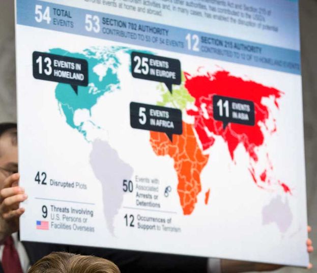
This map showing Mexico and Canada part of the “Homeland” was used during an NSA briefing showing where terror events were disrupted under current surveillance programs.
What is one to conclude from this? An “error” which I’m sure will be the official message or a hope by those systematically dismantling the US?
I don’t see it as an error, although as the article suggests it may show the reach of the NSA’s programs. Are/ will people jump the gun after seeing this screaming “NWO NWO”!? I don’t doubt it, but I’d like to hear some clarification especially since other territories are defined. This is a bit odd but you can see how each zone is defined by a color, labeled as “Events”. I don’t think anything is meant by this they should have called it “Events in Americas”, but based on the regimes activities we have to suspect ulterior motives with everything now!
1776 - Saving the Republic